Bureau of Land Management
U.S. Department of the Interior
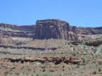
Most of the dramatic scenery along Highway 211 lies within
Canyon Rims Recreation Area. These public lands feature
numerous scenic viewpoints and many miles of dirt roads
through colorful terrain. On the Beef Basin and Lockhart Basin
four-wheel-drive roads you can explore remote areas and
enjoy backcountry camping.
In some sections of Canyon Rims Recreation Area, vehicle
travel is restricted to provide for non-motorized recreation and
to protect sensitive resources. Those areas offer outstanding
hiking, backpacking, horseback riding, and rock climbing.
For current information contact the Bureau of Land
Management offices in Monticello or Moab.
Newspaper Rock Recreation Site
Bureau of Land Management
Newspaper Rock displays figures and symbols of historic
Ute Indians as well as Ancestral Puebloans. Some of the rock
art is a thousand years old.
Newspaper Rock Recreation Site is 12 miles/ 19 km west
on Route 211, in a canyon with a perennially flowing stream.
Short walking trails lead to areas where you can observe desert
plants and animals as well as ancient rock art.
The recreation site is usually accessible year-round.
For additional information contact the Bureau of Land
Management office in Monticello.
Manti-La Sal National Forest
Monticello District
U.S. Forest Service
National Forest lands form the scenic backdrop for Highways
211 and 191. The terrain is full of extreme contrasts, from deep
sandstone canyons to timbered mountain peaks.
The Blue Mountain Harts Draw Loop Road, an 18 mile/ 30 km
scenic drive, ascends to high mountain meadows as it travels
south from Highway 211 to the town of Monticello. In fall the
oak and aspen foliage is spectacular.
The Elk Ridge four-wheel-drive road follows along a narrow
mesa with ponderosa pine forests, meadows, and mountain
views. This road travels past several unique geologic formations.
Watch for wildlife when driving mountain roads.
The National Forests in the vicinity of Monticello and Blanding
have more than 200 miles/ 330 km of trails for hikers, mountain
bikers, horseback riders, and ATV users. For further information
contact the Forest Service office in Monticello.