Entry Points:

About Honeyville
In 1861, a ferry was built for crossing the Bear River, which passes by a mile west of Honeyville. A sawmill was also built by Anson Call, which was later sold to Abraham Hunsaker. The settlement was known as Hunsaker’s Mill until 1877, when an LDS Ward was organized by the name of Honeyville.
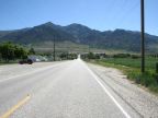
Honeyville is built on the foothills of the Wasatch Mountains. Box Elder Peak, just four miles east of Honeyville is 9,372 feet in elevation. A flat grassland lies to the west called the Bear River Valley. Several miles to the southwest, the Bear River reaches the Great Salt Lake.
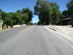
Utah Highway 38 passes through Honeyville going north-south. To the north, it connects to Utah Highway 30, and a few miles to the south, it reaches Brigham City. Utah Highway 240 begins at Honeyville and heads west to Interstate 15, and then to Utah Highway 13. Interstate 15 passes by Honeyville just to the west, and carries most of the traffic through the area.
Honeyville’s population was 1,441 at the 2010 census. The elevation is 4,270 feet on the west side of town, and houses have spread up into the hills to about 4,500 feet.
For More Information:
See Wikipedia’s Honeyville article.