Entry Points:

About Howell
Howell is the only town in Blue Creek Valley, a valley that runs for about eighteen miles from near the Idaho border in a straight line southward to where it narrows down to a canyon. Blue Creek, in wet seasons, flows out through the canyon and into Great Salt Lake, several miles further south. The mountains to the east are called the West Hills (obviously named by people living on the other side of them), and those to the west are called the Promontory Mountains. These mountains are moderate in height for the area, reaching above 6,000 feet, which puts them a couple thousand feet higher than the valley floor. One peak to the west of Howell, named Howell Peak, reaches 7,114 feet in elevation.
Since the mountains are not tall, not a lot of rain falls on them, and the area is quite arid. But Blue Creek does provide enough water to fill the Blue Creek Reservoir, which is just north of Howell, and with it's help provide irrigation for significant areas of farmland. Some dry farming is done in the area also. Some areas of trees can be seen on the mountains, but otherwise grasses dominate the scenery, along with some sagebrush and willows along the creek.
Right in the middle of the valley, about halfway up, north to south, stands Anderson Hill, a 1,000-foot-tall butte, which seems to defy the geologic pattern of the area. Howell is located at the base of this hill at its southwest corner. The hill blocks the view northward, but provides a nice view of the valley to the south.
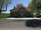
Interstate 84 passes through Blue Creek Valley on the north side of Anderson Hill, missing Howell. Utah Highway 83 begins at an interchange on the freeway, and passes down the east side of Anderson Hill and then cuts across diagonally to a point south of Howell and then continues south. Two roads connect from Howell to the highway, Blue Creek Drive which cuts eastward over the southern tip of Anderson Hill, and East Canal Drive which heads southward to meet the highway. A scattering of houses has reaches from the center of Howell down East Canal Drive to the highway. At the main intersection of Howell, at Blue Creek Drive and 17,400 West Road, is found an old school building which now serves as a city hall, a new school, and a Mormon Church. Houses are sparsely located along rural roads around Howell, and there is no grid of streets or population center to the town.
The story of the settlement of Howell begins with the first Transcontinental Railroad which was completed at a point several miles south of Howell now known as Golden Spike HIstorical Site in 1869. Charles Crocker, who oversaw the building of the railroad, came into possession of large areas of land in Blue Creek Valley and formed the the Promontory Land and Livestock Company. In 1909 this land passed into the hands of the Promontory-Curlew Land Company. Joseph Howell, a Utah congressman, was involved in the management of this company, and he became the namesake of the new community. From this company, the town's first resident, Nephi Nesson, purchased a 1,000 acre ranch and built a home. He was a Mormon pioneer of Danish ancestry, who came from Logan Utah. A number of other Mormon families soon joined him.
At the south end of Blue Creek Valley is located the ATK plant where space shuttle rockets and other rockets are produced. This has no doubt brought a few residents to Howell who don't ranch for a living.
The population in 2010 was 245. The elevation ranges from about 4,540 to 4,560 feet.
Street Index
|
17400 West Road 18000 West Road 18720 West Road a dirt road |
Blue Creek Drive East Canal Road State Highway 83 Wild House drive |