Entry Points:

About Emery County
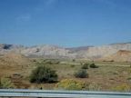
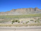
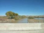
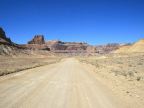
The San Rafael Desert occupies the bulk of Emery County. The Wasatch Plateau, a mountainous area, covers the northwest corner of the county, and the Green River forms its eastern boundary. The name "Castle Country" has been given to the area between the Wasatch Plateau and the San Rafael Desert, because of its many cliffs, mesas and stone formations. The San Rafael Reef is a dramatic formation of uplifted rock which pushes out of the desert floor at an odd angle and can been seen from a great distance. Rivers flow out of the Wasatch Plateau, supporting the communities at the base of these mountains, where the main population of the county lives.
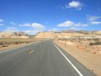
Emery County covers 4,452 square miles and is home to 10,860 people (as of the year 2000). Interstate 70 crosses the county east to west, making a dramatic climb through the San Rafael Reef. U.S. Highway 6 and 191 (a combined route) leave Interstate 70, traveling northward toward Price and Utah Valley. Utah Highway 10 follows the base of the Wasatch Plateau from Price southward to Interstate 70. Utah Highway 24 leaves Interstate 70 southward , traversing the San Rafael Desert towards Hanksville.