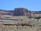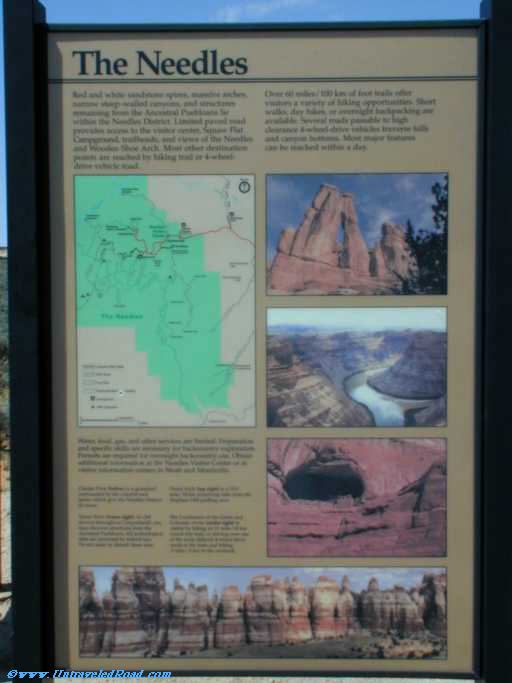
The Needles
Red and white sandstone spires, massive arches,
narrow steep-walled canyons, and structures
remaining from the Ancestral Puebloans lie
within the Needles Districts. Limited paved road
provides access to the visitor center, Squaw Flat
Campground, trailheads, and views of the Needles
and Wooden Shoe Arch. Most other destination
points are reached by hiking trail or 4-wheel-
drive vehicle road.
Over 60 miles/ 100 km of foot trails offer
visitors a variety of hiking opportunities. Short
walks, day hikes, or overnight backpacking are
available. Several roads passable to high
clearance 4-wheel-drive vehicles traverse hills
and canyon bottoms.
Water, food, gas, and other services are limited. Preparation
and specific skills are necessary for backcountry exploration.
Permits are required for overnight backcountry use. Obtain
additional information at the Needles Visitor Center or at
visitor information centers in Moab and Monticello.
Chesler Park (below) is a grassland
surrounded by the colorful rock
spires which give the Needles District
its name.
Tower Ruin (lower right). In cliff
alcoves throughout Canyonlands you
may discover structures from the
Ancestral Puebloans. All archeological
sites are protected by federal law.
Do not enter or disturb these sites.
Druid Arch (top right) is a 10.8
mile/ 18 km round-trip hike from the
Elephant Hill parking area.
The Confluence of the Green and
Colorado rivers (center right) is
visible by hiking an 11 mile/ 18 km
round-trip trail, or driving over one
of the most difficult 4-wheel-drive
roads in the state and hiking
.5 mile/ .8 km to the overlook.