Entry Points:

About Utah County
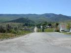
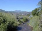
At the center of Utah County lies Utah Valley, a wide grassland lowland surrounded by the peaks of the Wasatch Mountains and other Rocky Mountain ranges. Mount Timpanogas' 11,749-foot peak towers above the valley, and is a popular summer retreat from the heat. Utah Lake covers a large part of the valley floor. The rich farmland of the valley today is steadily being replaced by urbanization. Being a close neighbor of Salt Lake City, the area has seen tremendous growth as people have found its healthy environment ideal for living and raising families. Cities line the east side of the lake, while the western slopes border on the desert and are more open. The county extends deep into the mountains on the east side where National Forests and ranches occupy a vast area.
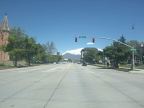
Soon after the Mormon Pioneers' arrival in Salt Lake City, settlers were sent to colonize the Utah Valley. Provo was settled in 1849, and is the county seat and largest city. Numerous other towns sprouted up where creeks supplied water for irrigation along the mountains.
As of the year 2000, the county is home to 368,536 people. Interstate 15 serves the area for travelers heading north and south. U.S. Highway 189 climbs Provo Canyon, leading to the northeast, and U.S. Highway 6 climbs Spanish Fork Canyon, toward the southeast, and also heads into the deserts to the southwest.
Street Index
|
a dirt road a trail a turnout |
Bennie Creek Road Brimhall Canyon Trail Diamond Fork Road |
F.S Route 031 Red Ledges Turnout U.S. Highway 89 |