Entry Points:

About Bear River City
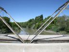
Bear River City sits on the banks of the Bear River in the rich farmland of the Bear River Valley. Wellsville Mountain is just a few miles to the west, towering 5,000 feet above the town. The Bear River passes in a meandering channel about forty feet lower than the town. It forms the eastern boundary of Bear River City. The Malad River, a much smaller tributary, also flows by not far to the west and they converge a few miles to the south.
Bear River City was settled by Mormon Scandinavian settlers in 1866, who first lived in dugouts in the side of the banks of the Bear River. The next year they built a fort for protection from Indians, made of 44 cabins with all the doors and windows facing inwards. Now (as of 2010) there are 853 people in Bear River City and the town maintains a rural flavor and houses are spaced luxuriously.
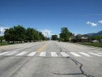
Interstate 15 passes by Bear River City a couple miles to the east, separating it from the traffic and commercialization of the freeway. The Main Street of Bear River City used to be U.S. Highway 191, which was decommissioned when the freeway was built. Now it is designated Utah Highway 13. It leads southward to Corinne and northward to The Crossroads, where it meets Utah Highway 102 at the edge of Tremonton. The elevation at Bear River City ranges from 4,250 feet to 4,268 feet. The highest elevation is at the top of the river bank, and it drops gradually to the west.