Entry Points:

About Tremonton
Tremonton was first settled in 1888 about the time that the West Canal was built to bring irrigation water to the west side of the Bear River Valley. In 1898, land agents promoted the site to midwestern farmers and attracted groups of non-Mormons to settle here, including a large group from Tremont, Illinois who were members of the Apostolic Christian Church and of German ancestry. The townsite was laid out in 1903 and named Tremont, after the town in Illinois. It's non-Mormon population contrasted that of most of the surrounding towns, it being in the middle of an area which had long been settled by Mormon pioneers. The name Tremont caused confusion with the town Fremont, located in Central Utah, and the Post Office changed it to Tremonton 1907. About that time, many of the German settlers returned to the mid-west and Tremonton became a predominantly Mormon community.
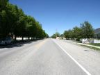
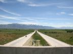
Tremonton is centrally located in the Bear River Valley, a fertile farming area north of the Great Salt Lake in northern Utah. The valley is roughly in the shape of the letter 'J', with Point Lookout Mountain protruding southward into the valley and ending right next to Tremonton. The Bear River flows into the valley through the Cutler Gap in the northeast corner of the valley and meanders southward into Great Salt Lake. It misses Tremonton by a few miles to the east. The Malad River is a smaller river that originates in Idaho, directly to the north and passes right through the eastern edge of Tremonton. The mountains along the east side of the valley are in places very lofty, bringing down lots of moisture. Wellsville Mountain is directly east of Tremonton and has several peaks that reach above 9,000 feet. Point Lookout Mountain is much lower, falling short of 7,000 feet. It is the southern tip of mountains called the West Hills which extend for miles northward. To the west, Thatcher Mountain is the high point in a range called the Blue Spring Hills, reaching 6,205 feet in elevation. These mountain ranges all run in the north-south direction. Many miles of farmland lie south of Tremonton between these mountains, and to the northeast.
Point Lookout Mountain is named for an interesting geologic feature on its southern tip. A narrow hill extends for a couple thousand feet out over the valley floor, about one hundred feet above it, making a lookout point. It then drops abruptly to the valley floor where a large spring of salty water emerges and flows in a creek down to Salt Lake. The spring is called Salt Spring and the creek Salt Creek. Interstate 84 passes right over the north end of Point Lookout.
Tremonton has a close neighbor, Garland, which borders it on the north. The two towns have grown together and Tenth North Street of Tremonton is 1400 South Street of Garland, and Third East Street of Tremonton is Main Street of Garland, potentially causing some confusion when crossing the city limits.
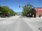
Interstates 15 and 84 have the interchange in Tremonton. Interstate 15 approaches from the north and 84 from the northwest. In the other direction they are combined and head southeast for a few miles before turning southward. While I-84 shares the route with I-15 southward to Ogden, locals think of this route as I-15. Two state highways serve Tremonton. State Highway 102 begins at the eastern edge of the Bear River Valley, at Deweyville, and heads directly west to Tremonton, where it is Tremonton's Main Street. It continues west for several miles, then turns southward to meet Utah Highway 83 at the south tip of the mountains on that edge of the valley. State Highway 82 begins in Tremonton and heads north up Third East Street into Garland. Utah Highway 13 misses Tremonton just barely to the east. This highway used to be U.S. Highway 191, which was decommissioned when the freeway was built. It goes north to Riverside, and south to Bear River City. Another historic U.S. route also passed through Tremonton. U.S. Highway 30 had a southern alternate route, which followed the route now used by I-84 to the northwest and passed through Tremonton on Main Street, and turned south to join U.S. Highway 191. That junction became known as The Crossroads.
The elevation at Tremonton ranges from about 4,300 feet, next to the Malad River, to about 4,500 feet, where the town has expanded up onto the slopes of Point Lookout Mountain. The population was 7,647 people at the 2010 census, an increase of more than 2,000 since the 2000 census. The combined town, with Garland, is over 10,000 people and it is a thriving community benefitting from agriculture, industry, and travel on the freeways.