Entry Points:

About Iron County
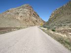
Iron County covers 3,302 square miles of country close to the southwest corner of Utah Barren deserts, alternating with mountain ranges cover the western portion of the county. A tall range of mountains, reaching to elevations over 10,000 feet stand on the eastern boundary of the county. The major towns of Iron County lie at the feet of these mountains, relying on the water flowing out of their canyons. Cedar City is the largest city in the county, and one of the fastest-growing cities in Utah. Parowan is the oldest settlement in the county, and is the county seat.
Two national park units are included in Iron County, Cedar Breaks National Monument, and the northern tip of Zion National Park. The mountains are beautiful with miles of quaking aspen and evergreen forests and alpine lakes broken by frequent and dramatic lava flows.
Interstate 15 is the main artery through the Iron County, traveling north and south along the foot of the eastern mountains. State Highway 56 travels into the western desert, ending at the Nevada border. State Highway 143 climbs into the mountains through Parowan Canyon, passing Brian Head Ski Resort and Cedar Breaks Monument, leading to Panguitch to the east. State Highway 14 heads eastward into the mountains from Cedar City. U.S. Highway 91 used to pass through the county, but was replaced by Interstate 15. State Highway 20 connects between I-15 and U.S. Highway 89 in the northeast corner of the county.