Entry Points:

About Fountain Green
Fountain Green is town of 1,071 people (2010 census) in the northwest corner of Sanpete Valley. The San Pitch Mountains stand a short distance to the west, and the Moroni Hills to the west, and the valley extends for many miles to the south.. An arm of the valley extends to the northwest where it reaches a pass connecting to the canyon of Salt Creek which drops down to the town of Nephi. Sanpete Valley is filled with farmland and dotted with numerous small towns..
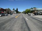
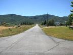
State Highway 132 passes through Fountain Green, named State Street, heading north and south. It passes along the eastern edge of the town, with a grid of streets extending to the west. Heading north, it connects to Nephi, and southward, to Moroni. West Side Road also heads south from Fountain Green, leading to Wales.
In the mid-1800s, Fountain Green was a camping spot known as Uinta Springs. In 1853, four men were killed by Indians while camping here. The townsite was platted in 1859 by Albert Petty, and George W. Johnson and a group of settlers established the town. Big Springs, a mile to the west in the mountains, provides water and electricity. Lamb Days is an annual celebration held in Fountain Green, commemorating the sheep industry in the area. The elevation ranges from 5,800 feet at the southeast corner to about 6,000 feet along the west side.
For More Information:
See the article in Wikipedia, Fountain Green, Utah.