Entry Points:

About Bear River Valley
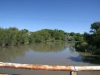
The Bear River is one of the longest inland rivers in the world, flowing 350 miles from the Uinta Mountains in Utah to the Great Salt Lake. On its way, it passes through Wyoming and Idaho, before returning to Utah. There are several areas along its path called Bear River Valley, and of these the Bear River Valley in northern Utah is the largest and most populated. The Bear River enters this valley at its northeast corner, passing through a narrow gap in the mountains. It flows through the valley in a gorge a hundred feet deep, which gradually becomes less deep as it approaches the Great Salt Lake. In addition to the Bear River, the Malad River flows through the valley, about a mile west of the Bear River most of the way, until they converge a short ways north of Great Salt Lake.
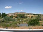
The Bear River Valley lies to the north of Great Salt Lake, and is an arbitrarily corner sectioned off of the vast basin which covers western Utah. A mountain range borders it on the east. This range is really an extension of the Wasatch Mountains which extend a hundred miles southward. Wellsville Mountain is the last major peak in this range, and to the north it dwindles to the size of a hill, offering a place for the Bear River to pass through. North of that it grows to a large range again and extends northward into Idaho. Clarkston Mountain is the name of the first big mountain in that part of the range, and it extends westward to form a northern boundary to the valley, but it ends at the Malad River, and a narrow valley, extending northward from there, is called Malad Valley. Point Lookout Mountain lies on the west side of the Malad River, and extends southward into the middle of Bear River Valley, where it abruptly ends. Bear River Valley wraps around Point Lookout Mountain, and extends northward for several miles on its west side, giving the valley roughly the shape of the capital letter 'J'. The west side is bordered by a low mountain range called the West Hills.
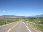
Around the year 1900, a canal was built to bring irrigation water from the Bear River to the west side of the Malad River, which opened up the largest part of the valley to farming. Today the valley is filled with farmland and crops of wheat and corn are commonly seen. At the same time, the major towns of the valley, Tremonton and Garland sprung up. The valley is divided up by a patchwork of rural roads, mostly spaced at one-mile increments. The hills above the reach of irrigation are barren, and the areas closest to Great Salt Lake are swampy with some salt flats. Numerous smaller towns dot the valley, and farmhouses line the roads.
Tremonton is located just at the base of Point Lookout Mountain. Interstate 15 approaches from the southeast, passes around Tremonton and turns north to go up the east side of Point Lookout Mountain. Interstate 84 branches off of it in Tremonton, and continues up the west side of Point Lookout Mountain. Before the freeways were built U.S. Highways passed through the Valley also, following roughly the same route. U.S. Highway 191 went through the valley on the east side of Point Lookout Mountain, and now that Highway is designated Utah Highway 13. U.S. Highway 30 had a southern alternate which followed the route of Interstate 84. Four other Utah Highways serve the valley: Highway 83 goes southeast to northwest along the southern edge; Highway 102 goes east-west across the valley through Tremonton, turning south at the West Hills to reach Highway 83. Highway 38 passes along the eastern edge of the valley from Brigham City to Highway 30, and Highway 30 heads east from Interstate 165 to Logan in Cache Valley.
The first transcontinental railroad passed through Bear River Valley and the final connection was made at Golden Spike, several miles to the east.
Point Lookout Mountain is named after a singular feature at its southern tip. A narrow hill extends for about 2000 feet out from the mountain, about 199 feet above the valley floor, making a natural lookout point. Just below its ending is a spring of salty water, named Salt Spring, which flows down Salt Creek into Great Salt Lake.