Entry Points:

About Delta
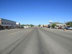
The city of Delta is found in the wide, open valley of the Sevier Basin, not far from the Sevier River. It is an agricultural area, with farmland extending for miles in most directions. It is also an area where the desert was made to “blossom as a rose” using irrigation water from the river. Beyond the reach of irrigation lies a barren desert which stretches for many miles to the west and south. The Sevier Basin is the old lakebed of Lake Bonneville and one of the last to be under water. When settlers arrived, a remnant of the lake still survived at Sevier Lake, but the use of irrigation water was the last blow to the lake, causing it to dry up.
In 1906, Frederick R. Lyman spearheaded the formation of the Mellville Irrigation Company to use water from the Sevier Bridge Reservoir to irrigate this area. They would have named the town Melville, but the name was already taken by a town in Cache Valley, so they called it Burtner. In 1910, a washout at a diversion dam caused problems and led to the formation of the Delta Land and Management Company. The new company vigorously promoted land at Burtner in far away places like California and the Midwest, attracting many new settlers. The next year they convinced the town to change its name to Delta.
U.S. Highway 6 & 50 was extended to Delta in the 1950s. They shared the same alignment, coming from the populous Wasatch Front to the northeast, and heading into the Sevier Desert to the southwest. Later on, a new U.S. Highway 50 was built east of Delta, separate from the U.S. Highway 6 route, leading southeast to connect to Interstate 15 at Holden. U.S. Highway 6 accesses other smaller towns of the Sevier Basin: Lynndyl to the northeast, and Hinckley to the southwest. Two state highways also begin near Delta: State Highway 257, on the west, heads south to Milford, and State Highway 125 leads eastward to Oak City.
The land is very flat at Delta, at 4,630 feet in elevation, with the exception of a modest bluff on the northeast of town rises about 100 feet higher. The Sevier River passes along the the west side of town, where it passes through the Gunnison Bend Reservoir. On a clear day, mountains can be seen around Delta. The closest are the Canyon Mountains, directly to the east. Slightly south and further east are the Pavant Mountains, a large range that form the eastern limit of the Sevier Basin. The Swasey Mountains lie at a considerable distance to the west and the Cricket mountains are a modest range to the south.
For More Information:
See Delta’s official website, www.deltautah.gov and a historical outline on www.OnlineUtah.com.
See also Wikipedia, Delta, Utah.