Entry Points:

About Millville
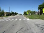
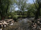
Millville sits at the base of the Bear River Mountains on the east edge of Cache Valley. It is a smaller residential community at the edge of the quickly growing Logan urban area. Utah Highway bypasses it half a mile to the west, and the Blacksmith Fork River flows between the town and the highway. The town has expanded into the foothills to the east, and the mountains just east of town reach to over 9,000 feet in elevation. The valley is filled with grassland and farmland and the mountains are forested. A minor canyon and a peak in the mountains are named after Millville.
Millville was settled in 1860 by residents at Elkhorn Ranch, which was located in Providence, a short distance to the north. It was named after the sawmill which was located here, and shortly after two gristmills, a molasses mill, broom mill, cider mill and a shingle mill were built here, so the name was very appropriate.
Millville has a population of 1,829 at the 2010 census. The elevation is 4,540 on the west side of town near the Blacksmith Fork River, and houses extend up on the mountain to about 4,800 feet. The Main Street of Millville heads north into Providence, becoming its Second West Street.
Millville was the childhood home of Craig Jessop, famous choral conductor and director of the Mormon Tabernacle Choir.
For More Information:
See the brief article on Millville in Wikipedia.